Ultimate Guide to the Olpererhütte Hike and Suspension Bridge, Austria
The Olpererhütte hike and its famous suspension bridge is one of the best adventures in the Austrian Alps, with stunning panoramic views and the most epic photo opportunities.
Olpererhütte itself is a quaint mountain hut situated at an altitude of 2,388 metres in the Tyrol region of Austria. The hike up to the hut offers incredible views over the Schlegeis Stausee reservoir, but it’s most well known for its floating suspension bride at the mountain summit which you’ll likely have seen photos of all over social media. Despite its popularity, this hike is certainly not overrated. In fact, I’d go as far as to say it’s in my top 3 hikes I’ve done in Europe.
In this guide, you’ll find everything you need to know before you head out on your hike to Olpererhütte. I'll provide instructions on how to access the trailhead and what to expect on your arrival, as well as describe the hiking route up to Olpererhütte and give suggestions on where to camp before or after your hike if you’re road-tripping around Austria.
Olpererhütte Hike Quick Facts
Starting/Ending Point: Schlegeis Stausee (Schlegeisspeicher reservoir) | Google Maps
Distance: 6.4km round trip.
Time Needed: 3-4 hours.
Elevation Gain: 620 metres
Difficulty: Moderate-Hard
Trail Difficulty
The Olpererhütte hike from Schlegeis Stausee is of moderate to hard difficulty, with the most direct route following trail 502. The elevation gain is over 600 metres and thus the path is fairly steep for the majority of the route, zigzagging up the mountain. Additionally, whilst the path is easy to follow, it is fairly rocky in parts and may involve some scrambling.
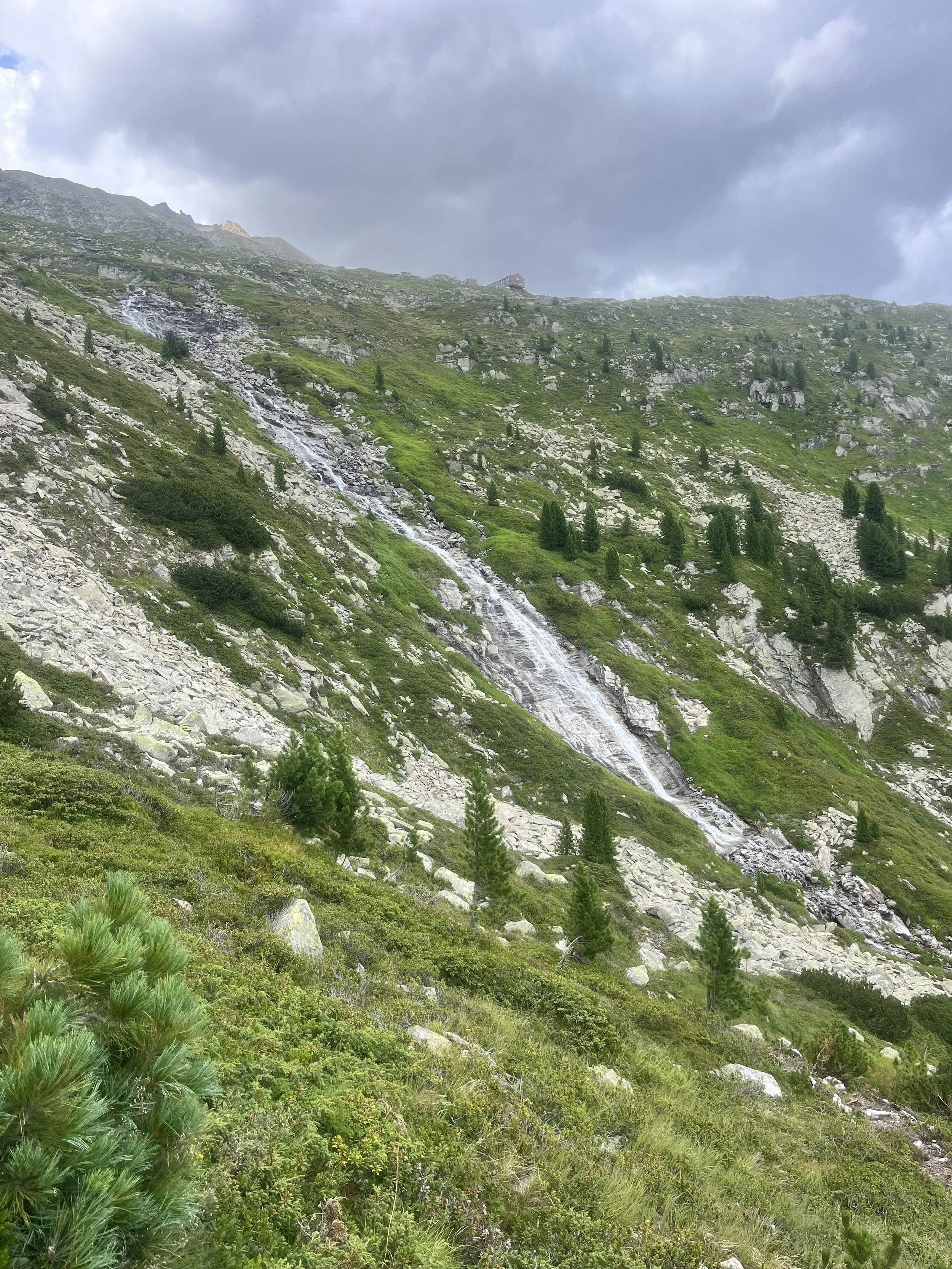
The hike is a 6.4km out-and-back route which should take 3-4 hours to complete (at least two hours up and one to come back down). Whilst undertaking this hike, I witnessed many unprepared hikers struggling with the wrong gear and not enough water. There are a couple of places where it’s possible to refill your water bottles during the hike - one is from a waterfall you pass midway up the mountain, and the other is from the Olpererhütte mountain hut near the summit.
The Olpererhütte hut is a great place to stop for a rest and refreshments whilst admiring the epic views across the reservoir and surrounding mountains.
Where to Start the Olpererhütte Hike
Schlegeis Stausee, Tyrol, Austria
The Olpererhütte hike trailhead begins from the Schlegeis Reservoir (1,800 metres), an artificial lake situated in the Zillertal valley of Austria. It is primarily used for the production of environmentally friendly electricity, as well as flood control. The reservoir is also the beginning of many other incredible alpine hikes and mountain activities.
You can reach Schlegeis Stausee directly by car from Ginzling via the Alpenstrasse Schlegeis toll road, a 13.3 km route that winds up the mountain with multiple switchbacks and natural rock tunnels with viewpoints.
The toll road is not accessible all year due to snow, but is usually open between May-October from 7am-6pm (or from 6am in July and August when the road opens an hour earlier due to high demand).
The toll is calculated per car, however it’s important to note that there is a driving ban on motorhomes, caravans and caravan trailers from the toll station, and minibuses and cars converted into camping vehicles are also affected by this ban.
To pay the toll, you can either use cash at the toll station midway up the road, or it is now possible to book your tickets in advance online (which is recommended). The price is 17 EUR for a car or 13 EUR for motorcycles.
Once you reach the Schlegeis reservoir, there are a couple of large car parks which are free to park in all day.
Alpenstrasse Schlegeis toll road tickets | Verbund.com
Can you get to Schlegeis Stausee by Public Transport?
If you’re not driving to visit Olpererhütte or you’re in a van or camper that are banned from using the toll road, it’s possible to take a direct bus to Schlegeis Stausee.
To access the hike via public transport, take the 4102 bus from Mayrhofen to Schlegeis Stausee. Most hikers catch the bus from the train/bus station stop in Mayrhofen. From here, it’s a 50 minute journey up the toll road to the reservoir and trailhead.
I’d recommend taking the earliest bus possible to leave plenty of time to enjoy the hike and allow for breaks to admire the view and take photographs. The last bus back down to Mayrhofen from the reservoir leaves at 6:10pm, so make sure you’re back down the mountain in plenty of time to catch this.
The cost of the bus is 10 EUR per person and tickets can be bought onboard via cash.
When I visited Olpererhütte in my self-converted van, I parked in Mayrhofen at the Ahornbahn Car Park then caught the bus up to the reservoir.
If you’re travelling without a vehicle, you can take the train to Mayrhofen from Innsbruck with a connection at Jenbach. This will take at about 1.5 hours.
Bus 4102 information and timetable | Christophorus.at
Olpererhütte Hiking Route Description
Once you arrive at Schlegeisspeicher reservoir, follow the lake round anticlockwise for around 12 minutes until you reach a signpost for Olpererhütte pointing to the right (trail 502). This will lead you up a clear gravel path that leads directly up to the Olperer Hut.
Straight away, the trail will climb fairly steeply up stone stairs that wind up the mountainside. The whole route is a pretty constant climb, so it’s important that you are moderately fit, take breaks when needed, and carry plenty of water.
The hike begins by ascending through forest and, although it’s a steep climb, it maintains an even terrain. As you continue, the landscape becomes more rocky with a stream running to your right. The higher you climb, the closer you’ll get towards this stream.
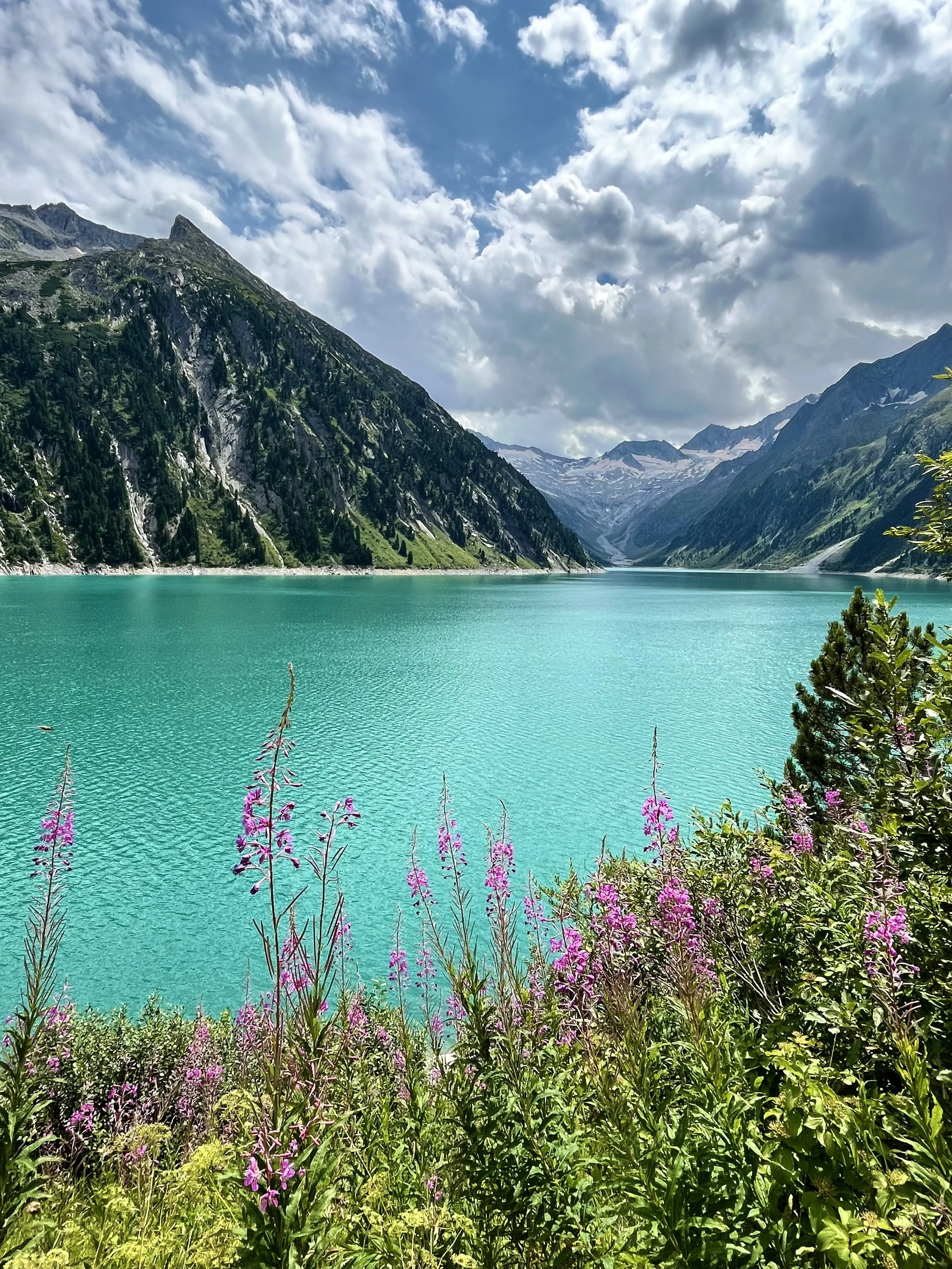
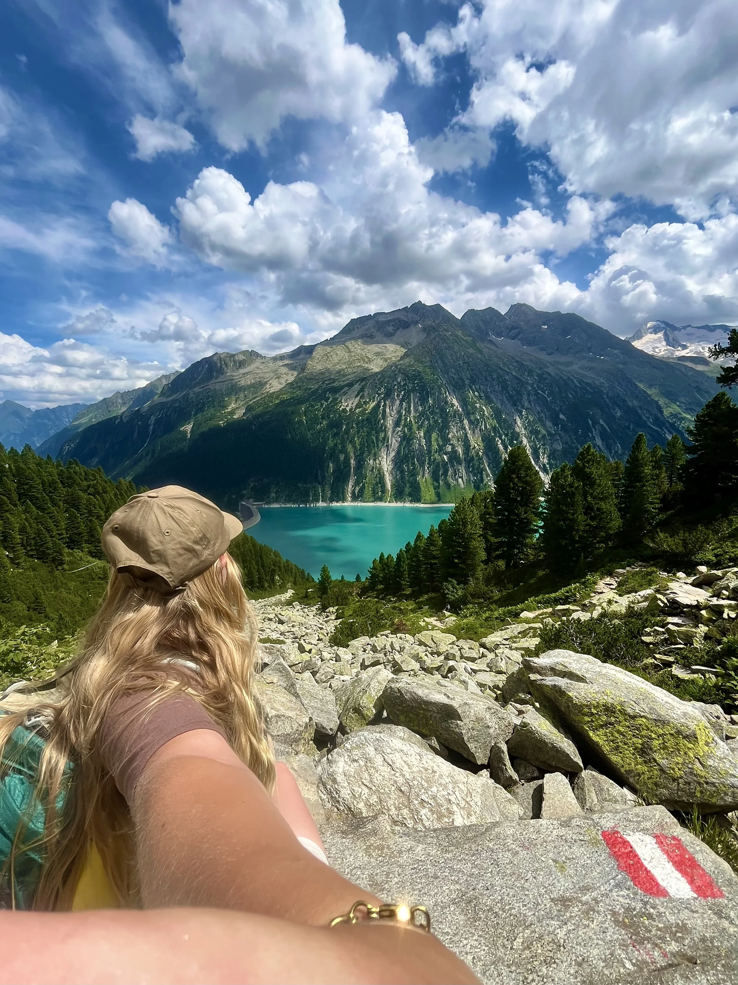
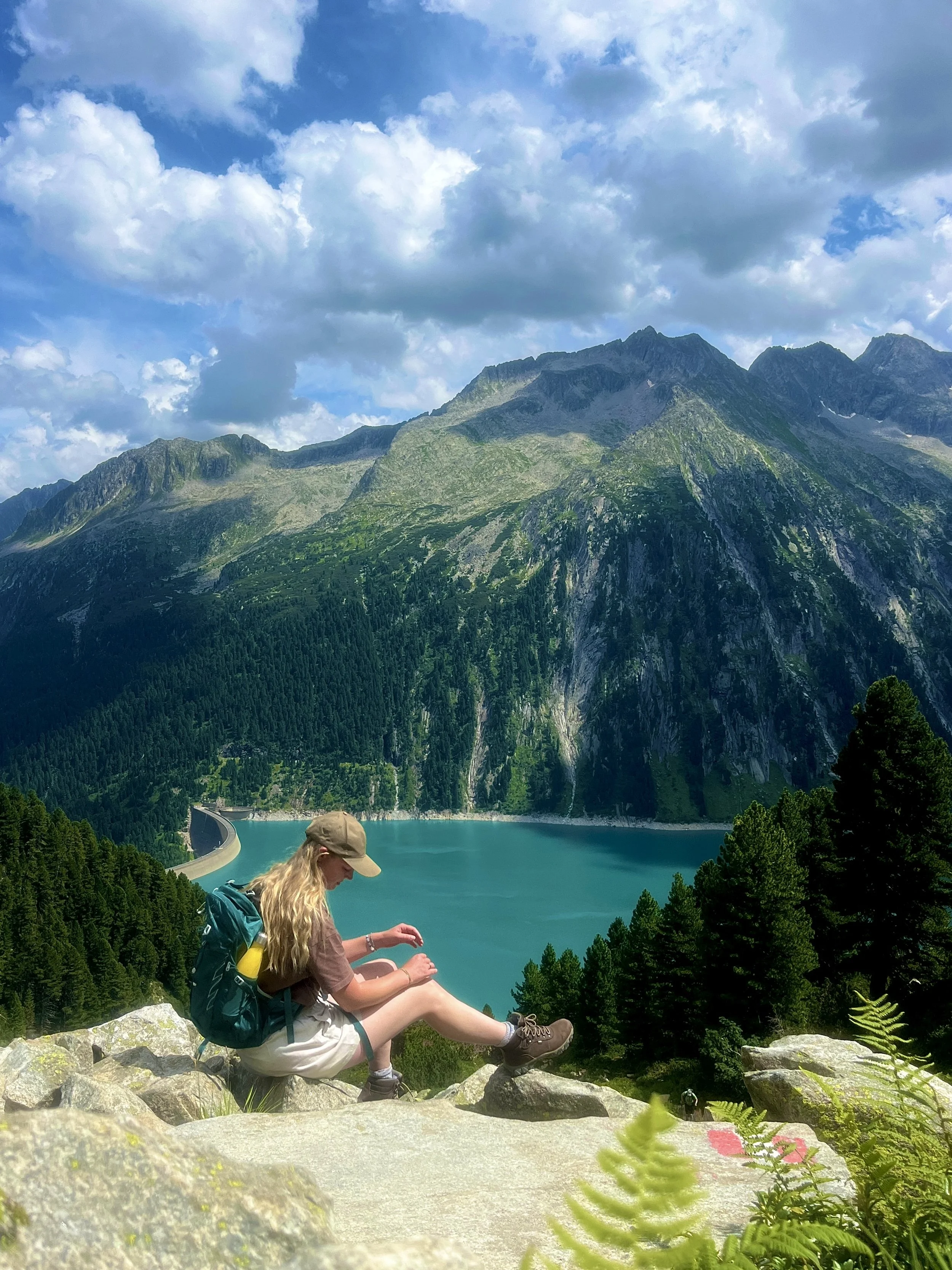
Whilst you walk, the reservoir will always be behind you so remember to turn around frequently to admire the view. The water of the lake is unbelievably blue, almost turquoise, so it makes for a beautiful contrast with the green mountains and trees surrounding it.
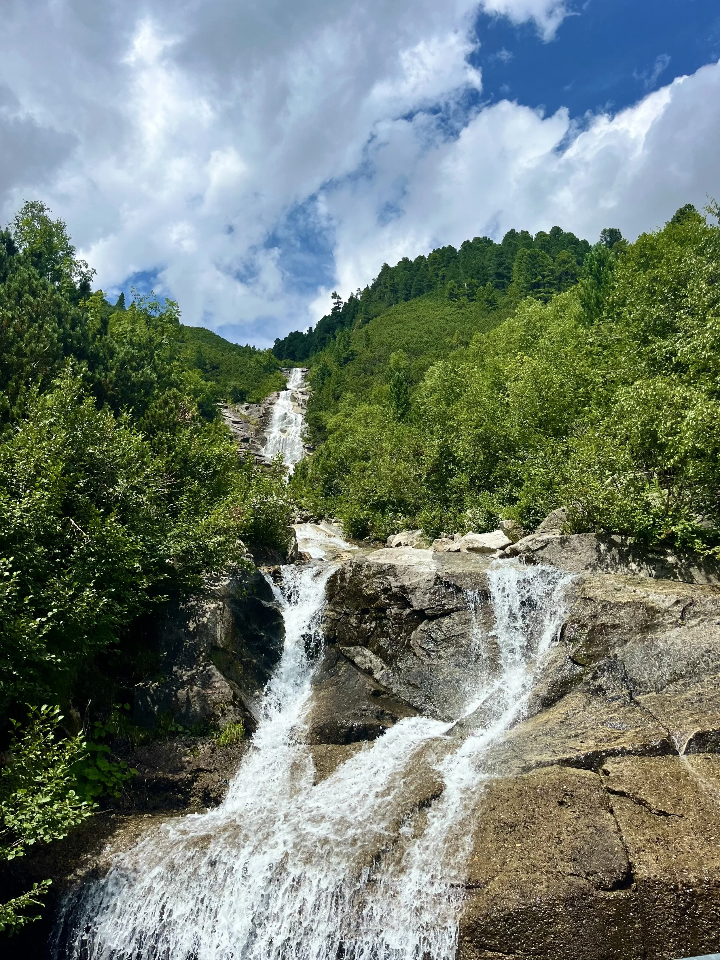
About half way up, you’ll be standing directly next to the stream where a waterfall descends down through forest on your right. Here, there is a water trough where you can refill your bottles directly from the fresh alpine water.
From this point it’s a continuous stony climb up towards the hut, which will soon become visible in the distance as you wind round to the right, crossing over the stream you just passed by a series of wooden bridges. At this point, the views are truly expansive and the scale of the reservoir is fully evident.
After a final steep ascent, you’ll reach the Olpererhütte, a cosy mountain hut and restaurant offering delicious Austrian food and refreshing beverages. Outside, a large terrace offers many bench seats situated perfectly to admire the view whilst recuperating. There is also another trough to fill up with water.
To get to Olpererhütte from the reservoir should take around 1.5-2 hours.
To return, simply turn around and head down the way you came up. This should take around an hour, and then an added 10 minutes to walk back to the car park/bus stop.
The Olperer/Schlegeis Suspension Bridge and Photo Opportunity
From the Olperer hut, I really recommend continuing your hike for an extra 5-10 minutes to reach the instagram-famous suspension bridge, where you’ll not only get one of the best views over Schlegeisspeicher reservoir but also have the chance to take an epic photo.
The reason why this photo opportunity attracts so many visitors each day is that the bridge creates a natural illusion that looks like it’s hanging hundreds of metres up in the air when (spoiler alert) it’s actually just a couple of metres above the ground. Because of this, you can create daredevil photos of you hanging from the bridge, sitting on its edge, or leaning over its sides which will leave viewers with their hearts in their mouths despite it being perfectly safe in reality.
to reach the bridge, continue following the hiking trail to the right behind the Olpererhütte, following signs for Friesenberghaus. After a short walk uphill, you’ll soon see the bridge, and probably a crowd of people surrounding it taking photos.
To get the best shots, walk towards the small stream behind the bridge looking out onto the view and set your camera up so that the bridge is in the centre of the shot. You can either ask someone to stand here and take a photo of you, or use a tripod and self-timer like I did. From this perspective, you get the full effect of the illusion so it looks as though the bridge is floating high above the lake.
Note, you may have to wait in line to get on the bridge to pose for your shot but that’s just the reality of visiting a social-media famous location!
Alternative Route to Olpererhütte Via Friesenberghaus
If you’d like to take a longer route up to Olpererhütte and thus avoid having to return the same way you came, it’s possible to head to another mountain hut, Friesenberghaus, before reaching the Olperer Hut.
To take this route, from the bus stop at Schlegeisspeicher reservoir look for a marked junction pointing towards ‘Friesenberghaus - 2 hours’ along trail 532.
The trail climbs gently through forest until you reach a wooden plank crossing a stream. Continue on the path across meadow with expansive panoramic views until you reach the Frieseberg hut. You could stop for lunch here, as a range of food and drinks are served from this location.
To continue towards Olpererhütte, take trail 536 signposted just outside the hut’s front door and continue on a descent towards the gorgeous Friesenberg Lake (Friesenbergsee).
After crossing a waterway, you’ll soon begin to climb steeply, navigating a rocky zigzag up the mountain. Once you reach a T-junction, turn left to walk along a level balcony trail towards Olpererhütte. Shortly before reaching the hut, you’ll hike across the famous suspension bridge.
When Can you Hike to Olpererhütte?
To access the Olpererhütte Hike you need to drive up the toll road to Schlegeis Stausee, which is only open from late May to early October.
Depending on weather conditions, the opening of the road may be delayed or it may close earlier in the year.
The best time to hike to Olpererhütte is in the summer or early autumn.
Find updates on Alpenstrasse Schlegeis toll road closures | Verbund.com
What to Wear and Pack for Hiking Olpererhütte
The Olpererhütte hike is a moderate-hard one and thus it’s essential that you wear the correct gear to safely ascend the trail. As the route is rocky and uneven, you will require sturdy hiking boots/shoes rather than ordinary trainers. Although not essential, a pair of hiking poles would be useful whilst climbing this trail too as it’s fairly steep.
As always, your clothing will be dependent on the time of year you choose to hike Olpererhütte. As the hut is at an altitude of 2,388 metres, the temperature here is likely to be colder than the nearest towns of Mayrhofen or Ginzling. In May, September, or October I’d suggest wearing trousers or leggings with a long sleeve top and packing a warm waterproof jacket.
If you’re planning to visit Olpererhütte in June, July or August, it is often shorts and t-shirt weather and the sun can be hot even at the summit.
The weather can be unpredictable in Austria, so whatever time of year you’re visiting Tyrol, always check the weather beforehand and adjust your clothing accordingly.
In addition, packing a plentiful supply of water is necessary for this hike and I would recommend taking sun-protection in the form of cream, a hat, and sunglasses too if hiking in the warmer months.
Van life and Overnight Parking near Schlegeis Stausee and the Olpererhütte
Unfortunately for us van lifers, wild camping is strictly forbidden in the Tyrol region of Austria, and thus there aren’t many spots to be found on popular park-up sites such as Park4Night.
The closest authorised overnight park-up is just a 13 minute drive from Schlegeis Stausee and the beginning of the Olpererhütte hike. It’s situated along the toll road up to the reservoir, however as it’s before the toll booth vans, campers and motorhomes can access this section and there’s no payment necessary to drive here. The camp spot is a small car park mainly used by climbers, named ‘Ewige Jagdgrunde camping’.
This park-up costs 17 EUR for 24 hours with an extra fee of 0.5 EUR per minute for a shower. There is also a toilet and space to wash dishes and cutlery.
As it’s a highly popular location, spaces do fill up fast so it’s best to arrive early. It is, however, a highly practical area to camp if you’re planning on visiting Schlegeisspeicher reservoir or the Olpererhütte hike.

